San Diego Maps for Travel Trade Pros
Where to find what you need around the region
The SDTA offers a comprehensive collection of maps for travel trade professionals, covering everything from regional overviews to special-interest locators. So whether you need details on San Diego’s beach regions or distances to the area's attractions, you’ll find what you need right here.
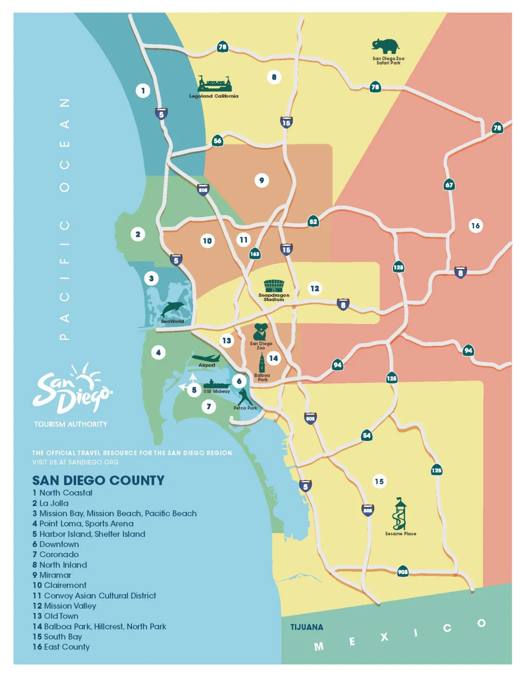
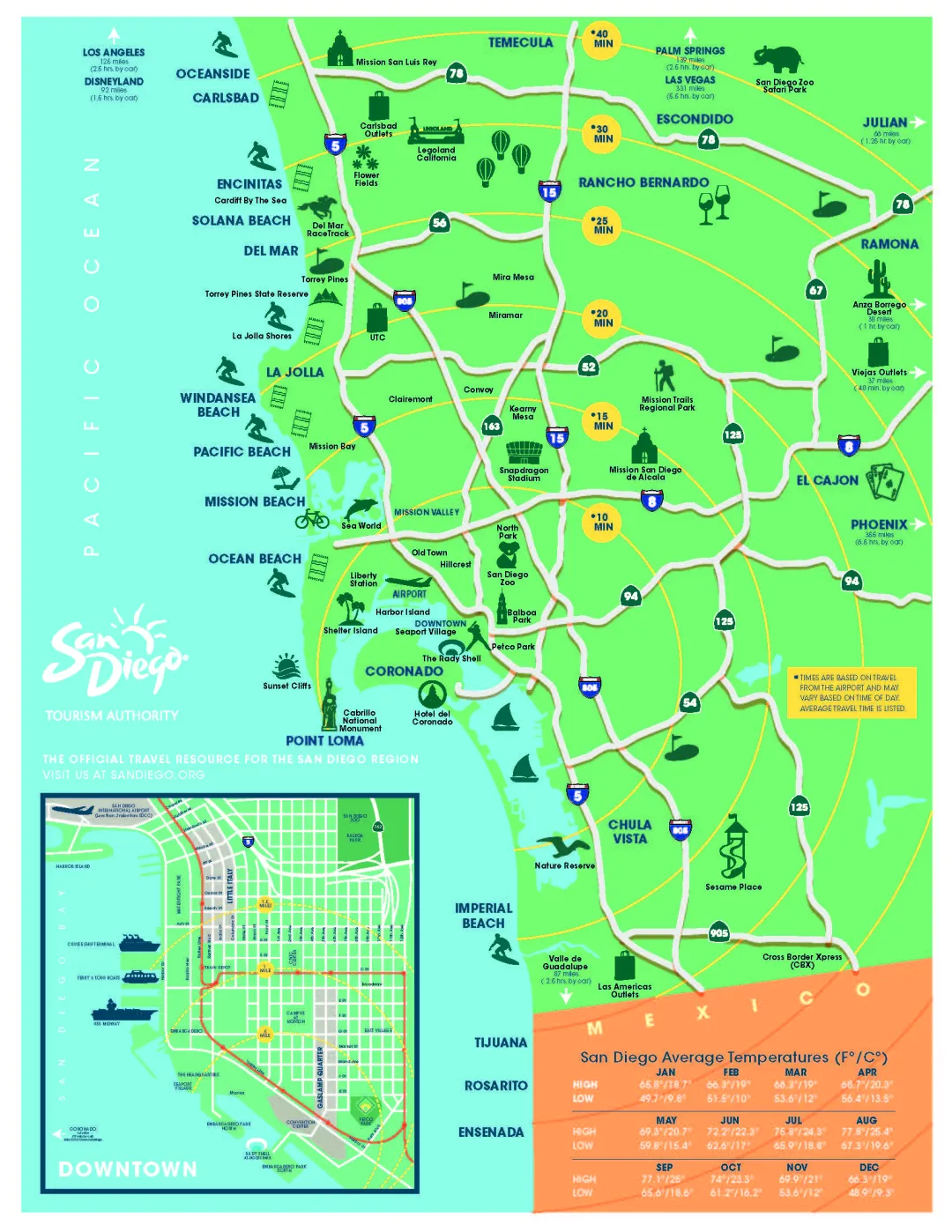


Official map of the San Diego Tourism Authority published in partnership with ARRIVED® magazine.
